
Offering stunning vistas of the snow-covered Dhauladhar ranges and the quaint villages in the Kangra Valley of Himachal Pradesh, Triund greets adventurers from McLeod Ganj, Dharamkot, and Dharamshala. Renowned as a beginner-friendly trek in the area, this blog provides every piece of information you need, serving as a DIY (Do It Yourself) guide for tackling the journey.
Triund Hiking Guide
Table of Contents
How To Reach?
There are two ways to reach the top of the Triund Hill. One’s relatively easy, while the other path requires a steep climb. We would recommend that you take the easy route while climbing up and the difficult one for your descent. It is your choice to do it both the easy way and the hard way.

We walked from our accommodation to the starting point of the hike. You could alternatively hire a taxi or an auto to reach the Galu Devi Temple.
Several hostels, cafes, and tour agencies offer guides, accommodation in tents, and food for INR 1000. To us, the freedom that comes with trekking was important. Therefore, we did not opt for the packaged tour and made do in our own way, as always!
Best Time To Visit Triund
Apart from July and August in the monsoon season and the peak winter period ranging from January to February, Triund is accessible during all the other months of the year. The entry is restricted when it snows. We would suggest that the safest and best time to visit this spot would be during the months of April, May, and June.
It is also best to go in early during the weekdays for a peaceful hike, as it is accessible from the nearby valleys and typically found crowded during weekends and holidays.
Network Availability
The Airtel and Jio networks had medium to good reception during our observation throughout the trek until the very end of the Triund summit.
ATM Availability
There are no ATMs near the hike’s starting points. You can find ATMs in McLeod Ganj, Dharamkot, and Dharamshala. The shops at the summit did not accept UPI payments, and we had to pay in cash. So, carry a fair amount of cash along with you.
Languages Spoken
The people in the region widely speak Hindi. The local languages include Pahari and Tibetian. Being a tourist destination, many people converse in English as well.
Parking Availability
There is a parking space available close to the Gallu Devi temple. You can park your vehicles there.
Restroom Facilities
You are dependent on nature from start to finish. There are no restrooms en route.
Where To Eat?

You can find a couple of cafes midway on either of the routes mentioned. Stock up on snacks and water, if needed. They also have piping hot maggi, bread omelets, beer, and soft drinks. We found a shop on the Triund campsite as well. The prices were comparatively higher since it was up on the mountains, and the effort to bring things uphill was factored into the cost. We suggest you carry fruits, snacks, and energy bars before you start the hike.
Where To Stay?
Triund can be done as a day hike or a 2-day hike. You can pitch your tent at the campsite over the summit. You do not need permission to do so. This gets you an amazing view of the sunset and sunrise in the Dhauladhar ranges. Be sure to check the weather and pack accordingly.
If you’re on a day hike, you can return to your accommodation on the very same day. There are several hotels in Dharamkot, MacLeod Ganj, and Dharamshala for you to choose from. Here are a few of our recommendations.
- McLeodganj Diaries
- Hobo Hostel
- The Unmad – Dharamkot
- Sakura Guest House
- Echor Mandara TreeVilla Dharamshala
- Radisson Blu Resort Dharamshala
Things To Do In Dharamkot
Unsurprisingly, trekking is a popular activity in the region. Apart from that, you can also find several other interesting things to do at McLeod Ganj, Dharamkot, and Dharamshala. Check out the blog we have that lists all the activities that you shouldn’t miss.
Hiking Details
Entry Fees: Free
Permission: Not Required
Camping: Allowed. You can camp at the Triund campsite at the summit.
Timings: Open 24*7.
Duration: 5 hours for the ascend, 3 hours to descend
Min-Max Altitude & Elevation Gain: 1742m – 2814 m
Hike Distance: 5 Km one way (same for both routes)
Water Resources: When we hiked in November, all the streams were dry. We couldn’t find any natural water source along the trail. It is best to refill your bottles at the shop mid-way or buy bottled water at the campsite. Make sure to bring at least 1-2 L of water per person or more if you are planning to camp.
Difficulty Level: Easy – Moderate, highly subject to your fitness level.
Terrain: Forests, rocks, steps, grasslands, and boulders.
Hiking Route:

The hike starts from Galu Devi temple, which is located at an altitude of 2130 m. A few direction arrows are marked at the start of the hike. Railings were installed for safety purposes.


After a few meters, you would come across spell-binding views of the Kangra Valley on your right. You can also chance to see the snow-covered Mun Peak.

The terrain is fairly easy to tackle and gradually increases till you reach the Magic Chai Shop. We suggest that you rest here for a bit since the next couple of km is pretty tough, and you need to ascend as you gain altitude. You would cross a couple of shops in this area, you should keep moving forward on the trail visible.

You would come across a red colored flag and a couple of buildings that would mark the campsite. And if you arrive early, before 11 AM, you could even extend your hike to the Triund Hilltop or else descend from the Triund campsite area.
Or, if you feel up to it, you can even camp out under the stars, hike up to the top, and descend the next day.
At Triund Campsite:

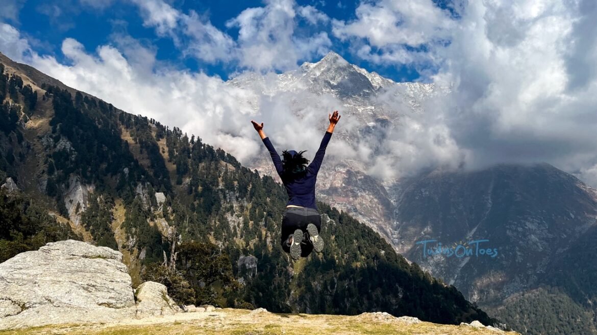
A board named Triund at 2875 m marks the Triund campsite. A few people call it the summit, but the actual hilltop is at a much higher altitude (3240 m) and is visible from the campsite on a clear day. You can relax at the campsite and soak in the scenic views of Mun Peak (4650 m) and other mountains in the Dhauladhar mountain ranges.

Like a scene from the Ghibli movies, the campsite looks like a wide meadow, and as an added bonus, it comes with a shop at the campsite. A few forest department buildings are situated within close range. There is a tiny Hanuman picture painted in the deity’s signature orange color on a stone.
As mentioned earlier, you could choose to come back in the same way or take a different route. We did the latter, coming back around Bhagsunag Waterfall.

There are camping spots midway for a rest break.

You should follow the direction marks while descending, where you will see a diversion for Bhagsunag. A few meters further, you would have to cross the forest section and reach the Bhagsunag waterfall before sunset hits since it gets pretty dark soon in those areas. You can then start your way back to your accommodation.
Important Points To Remember
- The use of plastics, smoking, and drinking of alcohol is strictly prohibited.
- As a hiker, it is incumbent on you to be responsible and not litter. Leave it better than it was before.
- The direction marks are marked at very few places along the trail. But the route is pretty much straight until the very end. So, hiring a guide is optional for this hike.
- Download offline maps from waymarked trails marked as (GDT – Galu Devi Triund) and upload them to OSMAND or maps.me.
Essential Things To Carry
- Ensure you carry at least 1 L of water per person.
- Cap, sunscreen & sunglasses are essential to ward off the heat.
- Take a sufficient amount of snacks and energy bars.
- Carry a poncho or a raincoat.
- The most important thing is to wear comfortable shoes as the hike distance is fairly long and the terrain is steep.
- Carry all the camping gear and extra layers if you’re planning to camp.
If you have any questions, feel free to comment below. For more detailed hiking guides such as this, travel tips, or anything related to travel, stick with us and follow us on social media handles – Instagram, YouTube, and Pinterest.